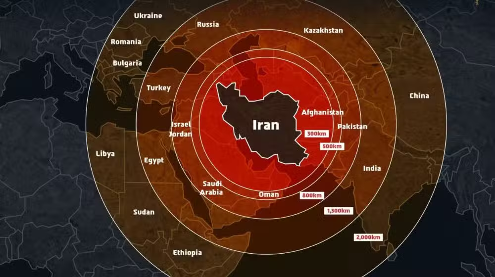
Amid rising tensions between Iran and Israel, a diplomatic controversy erupted online after the official Israel Defense Forces (IDF) social media account shared a map that mistakenly depicted the entire Kashmir region as part of Pakistan.

The map, intended to illustrate the missile range of Iran, quickly drew backlash from Indian social media users who viewed the depiction as a serious misrepresentation of territorial boundaries. Many in India, where Israel is often regarded as a strategic partner, expressed strong disappointment and demanded an immediate correction.
READ MORE:
Iran Launches Massive Missile Attack on Israel as Retaliation Escalates
Following widespread criticism, the IDF issued a public clarification, stating:
“This post is an illustration of the region. This map fails to precisely depict borders. We apologize for any offense caused by this image.”
The incident has triggered debate over the sensitivity of geopolitical visuals in diplomatic communications, especially amid ongoing conflicts and alliances in the region.